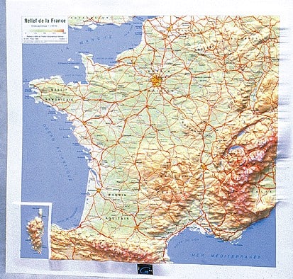
Some years ago we featured a satellite picture of France taken from space, which was fascinating in making clear the impact of the rivers and mountains on the geography, settlement and agriculture of France – esepcially vines.
The map was published by the Institut Geographique National (IGN) the French equivalent of the Ordnance Survey and main competitor to the ubiquitous Michelin maps.
IGN also publish a series of raised relief maps, which take the idea one stage further, especially in the mountainous regions, where you can really get an excellent appreciation of the landscape, slopes and peaks which dominate the country from the raised plastic contours of the map.
They range from a small map of the whole of France, to larger scale versions for specific regions – we used to have one of the Beaujolais region which was great to show customers where the cru regions were and how they connected to or were separated from adjacent vineyards. Unfortunately the wear and tear of a busy wine cellar, tastings and shows eventually took its toll.
However, such a thing could make a great Christmas present for an avid francophile, and properly mounted on the wall it should avoid the fate of our Beaujolais map.
Alternatively you can see the range at the IGN maps here

see our Top 30 vineyard B&Bs in France
find cheap flights and plane tickets from Booking.com
somewhere to stay, a ferry, a train or car hire?
stay on a French vineyard – over 250 vineyards featured across France – hotels, B&B, self-catering ![]()

Discover more from FrenchDuck.com
Subscribe to get the latest posts sent to your email.


